

A phone can show your location, but it cannot replace a map when the battery is low, the signal disappears, or several trails split around the same ridge. The right paper map should make those decisions easier without turning a quick trail check into a full cartography lesson.
Our Best hiking trail maps picks cover major national parks, regional trail systems, and compact wilderness maps. Some emphasize topographic navigation, while others are better at sorting day hikes by difficulty or showing useful trail junction details.
National Geographic Yellowstone Map is our top pick for its unusually complete trail coverage and practical navigation features. The rest of the list ranges from Glacier day-hike planning to pocket-sized Colorado maps and regional guides for Sedona and the Catskills.
Comparison table
| # | Product | Award | Coverage | Format | Best for |
|---|---|---|---|---|---|
| 1 | National Geographic Yellowstone Map | Best overall | Yellowstone National Park | Folded map | Broad park coverage |
| 2 | Hike 734 Glacier Day Hikes | Best for day-hike planning | Glacier National Park | Folded map | Choosing among day hikes |
| 3 | National Geographic Glacier Waterton Map | Best cross-border coverage | Glacier and Waterton Lakes National Parks | Folded map | Multi-park trips |
| 4 | National Geographic Mammoth Lakes Map | Best for GPS navigation | Inyo and Sierra National Forests | Folded map | Eastern Sierra routes |
| 5 | Outdoor Trail Maps Lost Creek | Best compact wilderness map | Lost Creek Wilderness | Folded map | Pocket-sized navigation |
| 6 | National Geographic Smokies Map | Best for park overview | Great Smoky Mountains National Park | Folded map | Exploring the Smokies |
| 7 | National Geographic Yellowstone Grand Teton Bundle | Best two-park set | Yellowstone and Grand Teton National Parks | Folded map bundle | Trips covering both parks |
| 8 | Emmitt Barks Sedona Trails Map | Best for Sedona | Sedona trail system | Folded map | Red-rock trail planning |
| 9 | New York-New Jersey Catskill Map | Best regional trail map | Catskill Region | Map | Catskills route planning |
| 10 | Outdoor Trail Maps Maroon Bells | Best lightweight Colorado map | Maroon Bells-Snowmass Wilderness | Folded map | Lightweight wilderness trips |
1. National Geographic Yellowstone Map: Best Overall

Pros
- More than 1, 000 miles of mapped trails
- Trail mileage, elevation, duration, and difficulty are included
- Waterproof and tear-resistant construction
- Printed UTM grid supports GPS navigation
- Shows major attractions, trailheads, campgrounds, and access points
Cons
- Covers Yellowstone only
- Folded map format takes some practice to refold neatly
- More information than a short day hike may require
Best for: hikers who want one detailed paper map for planning and navigating Yellowstone.
The first thing that stands out about National Geographic Yellowstone Map is how much useful information it puts in one folded sheet. This is not merely a park overview with a few scenic roads marked. It maps more than 1, 000 miles of trails and adds the details that help turn a line on paper into a realistic outing, including mileage between intersections, trail elevation, estimated duration, and difficulty.
The printed UTM grid is a serious advantage for hikers who carry a GPS device or compass. It gives the map a coordinate framework instead of leaving navigation entirely to visual landmarks. Contour lines, summit and pass elevations, lakes, campgrounds, boat ramps, marinas, scenic overlooks, and interpretive trails add context when a route crosses more than one kind of terrain.
This map is also strong before the hike starts. Mammoth Hot Springs, Canyon Village, Yellowstone Lake, Yellowstone Falls, Grant Village, and the Old Faithful geyser area are clearly called out, so it works for building a day-by-day park plan as well as checking a junction on the trail. The waterproof and tear-resistant construction is reassuring around rain, wet packs, and repeated handling.
Compared with National Geographic Yellowstone Grand Teton Bundle, this single map is the more focused choice for someone spending most of the trip inside Yellowstone. The bundle wins when the itinerary includes both parks, but this map gives Yellowstone more room to breathe. The weakness is scope: it cannot help once the trip moves south into Grand Teton, and its dense information can feel excessive for visitors who only want a quick view of one popular route.
If you want a dependable Yellowstone reference that supports both trip planning and backcountry orientation, this is the map we'd keep in the pack. It is especially suitable for hikers who want terrain information and coordinate support rather than a simplified tourist diagram.
2. Hike 734 Glacier Day Hikes: Best for Day-Hike Planning

Pros
- Covers 88 day hikes
- Uses color-coded trail segments to show steepness
- Identifies family-friendly and early-season hikes
- Provides descriptions that help set expectations
- Includes 234 recognized summits and high points
Cons
- More focused on hike selection than broad topographic navigation
- Released in 2014
- Limited feature data is provided beyond its hiking guide focus
Best for: visitors deciding which Glacier National Park day hikes fit their group and schedule.
Hike 734 Glacier Day Hikes takes a different approach from the large-format topographic maps in this roundup. Its useful question is not simply “where is the trail?” but “which hike should we do today?” The guide presents 88 day hikes with recommendations, descriptions, and labels that help a group narrow down the choices before leaving the campground or hotel.
The color-coded trail segments are the standout feature. Green indicates level trail, yellow indicates some incline, and red marks a plainly steep section. That visual language is easier to scan than trying to infer every change in grade from contour lines, especially when several people with different abilities are choosing a route together.
Family-friendly and early-season labels add another practical layer. They do not replace checking current conditions, but they help sort the park's options before spending time on routes that do not suit the season or the group. The inclusion of all 234 summits and high points recognized by the Glacier Mountaineering Society also gives experienced visitors a useful sense of the broader landscape.
This is a better trip-planning companion than National Geographic Glacier Waterton Map, which has the advantage when you need a wide, cross-border geographic view. The trade-off is important: Hike 734 Glacier Day Hikes is built around selecting and understanding day hikes, not around supplying the fullest possible navigation framework. It also has a 2014 release date, so hikers should confirm current closures, reroutes, and access conditions elsewhere.
Choose it if the hardest part of your Glacier trip is deciding what to hike. Skip it if you already know your route and mainly need a coordinate grid and detailed terrain reference.
3. National Geographic Glacier Waterton Map: Best Cross-Border Coverage

Pros
- Covers Glacier and Waterton Lakes National Parks
- Folded format is easy to carry
- Useful for itineraries crossing the international border
- National Geographic Trails Illustrated map design
Cons
- The supplied product details do not specify trail mileage or grid information
- Less route-selection guidance than the Hike 734 guide
- Does not focus on a single park in the same way as a dedicated park map
Best for: hikers planning a trip that includes both Glacier and Waterton Lakes.
National Geographic Glacier Waterton Map earns its place by covering two connected destinations rather than forcing a traveler to choose one side of the border. That makes it a natural fit for road trips and longer itineraries where the landscape matters more than the park boundary. A folded map is also a sensible format for moving between trailheads, viewpoints, and overnight stops.
The product information is sparse compared with the Yellowstone map. It confirms a folded Trails Illustrated format and identifies Glacier Waterton Lakes National Parks, but it does not provide specific trail mileage, scale, or GPS grid details in the supplied features. That means we would treat it as a broad planning and orientation map unless the printed map itself confirms more detail.
Its strength is geographic continuity. Hike 734 Glacier Day Hikes is more useful when a group needs to rank individual Glacier outings by steepness, family suitability, or season. This map is the better companion for understanding how the two parks fit together and for keeping a wider trip from becoming a collection of disconnected local decisions.
The lack of detailed published specifications is the real limitation. Hikers who depend on a coordinate grid or very specific trail data should compare the printed legend with their navigation needs before setting out. It is also less targeted than National Geographic Yellowstone Map, which spells out trail distances, duration, difficulty, and points of interest.
Buy this one when cross-border coverage is the deciding factor. It is a sensible regional overview for travelers who need to see the whole Glacier and Waterton area in one place, but not the strongest standalone choice for detailed route analysis.
4. National Geographic Mammoth Lakes Map: Best for GPS Navigation

Pros
- Full UTM grid for GPS-compatible navigation
- Waterproof and tear-resistant
- Covers the Mammoth Lakes and Mono Divide area
- Compact folded format
- Covers parts of the Inyo and Sierra National Forests
Cons
- The supplied features do not list trail mileage or difficulty
- Geographic scope is narrower than a national park map
- Less trip-planning guidance than the Glacier day-hike guide
Best for: hikers who want a durable coordinate-based map for the Eastern Sierra.
The appeal of National Geographic Mammoth Lakes Map is straightforward: it gives GPS-minded hikers the feature they need most, a full UTM grid. If you use a handheld GPS, coordinate-capable phone, or compass, that grid makes it easier to relate a device position to the paper map. It is a more useful navigation aid than a decorative trail overview.
The map covers Mammoth Lakes and Mono Divide across the Inyo and Sierra National Forests. Its waterproof and tear-resistant construction suits a region where a map may see dust, weather, and repeated folding. The folded dimensions are about 8.8 by 4.1 inches, with a listed weight of about 0.2 pounds, so it should fit naturally in a pocket or small map compartment.
There is less information here about trail-by-trail planning than on National Geographic Yellowstone Map. The supplied features do not state trail mileage, difficulty, or duration, so this is not the pick for hikers who want a ready-made list of routes. It is better understood as a navigation-focused regional map for people who already have a destination in mind.
That distinction also separates it from Outdoor Trail Maps Lost Creek, which lists trail segment distances and GPS coordinates for trailheads and junctions. The Mammoth Lakes map has the stronger stated coordinate grid, while Lost Creek is more explicit about compact on-trail use and route mileage.
Choose this map for Eastern Sierra trips where GPS compatibility and physical durability matter more than guided hike selection. Skip it if you need the map itself to explain which routes are short, steep, or family-friendly.
5. Outdoor Trail Maps Lost Creek: Best Compact Wilderness Map

Pros
- Compact 4 by 7 inch folded size
- Waterproof and tear-resistant
- 1:48, 000 scale
- Trail segment distances are included
- GPS coordinates mark trailheads and junctions
- Updated for 2022
Cons
- Covers only Lost Creek Wilderness
- Smaller scale may show less local detail than a larger map
- Less broad sightseeing information than the national park maps
Best for: backpackers who want a small, durable map dedicated to Lost Creek Wilderness.
Outdoor Trail Maps Lost Creek is designed around the moment when a map needs to come out on the trail, not spread across a kitchen table. Its folded size is 4 by 7 inches, and the product specifically emphasizes a smaller, lighter format. That makes it appealing for hikers who dislike carrying a large sheet that is difficult to refold in wind.
The 1:48, 000 scale provides a useful middle ground for showing a wilderness area without making the map unwieldy. More important for route decisions, trail segment mileage is included rather than leaving the hiker to estimate distances from the linework. GPS coordinates for trailheads and trail junctions add a practical bridge between paper navigation and a device.
The waterproof and tear-resistant construction is well matched to backpacking. The map was updated for 2022 with stated trail routings and distances, which is a meaningful advantage over products whose published details do not identify a recent update. Still, a printed update date does not replace checking current closures or conditions before a trip.
Compared with Outdoor Trail Maps Maroon Bells, this map has the newer stated update year and a slightly smaller listed folded width. Both share the pocket-oriented design, segment distances, and GPS coordinate approach. National Geographic Mammoth Lakes Map offers a full UTM grid, but Lost Creek is more explicit about trail junction coordinates and on-trail compactness.
Its narrow coverage is the obvious weakness. It is not a general Colorado map, and it will have little use outside Lost Creek Wilderness. For a trip centered there, though, the focused coverage and small format make it one of the most practical choices in the roundup.
6. National Geographic Smokies Map: Best for Park Overview

Pros
- Covers Great Smoky Mountains National Park
- Folded map format is portable
- National Geographic Trails Illustrated presentation
- Useful as a broad park reference
- Compact listed dimensions
Cons
- The supplied features provide little detail beyond park coverage
- Trail distances and navigation grid are not specified
- Less route-selection help than the Glacier day-hike guide
Best for: visitors who want a portable overview of Great Smoky Mountains National Park.
National Geographic Smokies Map is the straightforward park-specific option for Great Smoky Mountains National Park. It uses a folded format and has listed dimensions of about 8.87 by 6.46 inches, with a weight of about 0.2 pounds. That is compact enough for a day pack while still giving the map a practical footprint when opened.
The product details supplied here are notably brief. They identify it as a National Geographic map for the Great Smoky Mountains, but they do not specify trail mileage, scale, waterproof treatment, or a coordinate grid. We would not assume those features are present simply because similar maps in the same family include them.
That makes this a different kind of pick from National Geographic Yellowstone Map. The Yellowstone product explicitly describes more than 1, 000 miles of trails, mileage between intersections, trail duration and difficulty, UTM navigation, and numerous points of interest. The Smokies map may still be useful for broad orientation, but the published information does not support the same detailed claims.
It also lacks the itinerary guidance found in Hike 734 Glacier Day Hikes. There is no stated ranking of hikes, steepness color coding, or family-friendly labeling. Hikers who need that kind of decision support should look for a dedicated Smokies hiking guide alongside this map.
Choose it when you want a compact regional reference for a Smokies visit and already have your route information. If navigation detail is the priority, confirm the map's legend and coordinate features before relying on it as your only paper resource.
7. National Geographic Yellowstone Grand Teton Bundle: Best Two-Park Set

Pros
- Covers both Yellowstone and Grand Teton
- Waterproof and tear-resistant
- Marks hiking, biking, horseback, ATV, and other trails
- Includes UTM and latitude/longitude grids
- Shows roads, points of interest, and safety information
Cons
- The bundle is heavier than a single folded map
- Two-park coverage can mean less space for each individual area
- Less targeted than a single-park map for a Yellowstone-only trip
Best for: travelers combining Yellowstone and Grand Teton in one itinerary.
National Geographic Yellowstone Grand Teton Bundle solves a common trip-planning problem: the route does not end at the Yellowstone boundary. The bundle covers both Yellowstone and Grand Teton, making it the natural choice for a road trip that moves between the parks and needs a consistent paper reference throughout.
The feature set is broad. Trails for hiking, biking, horseback riding, ATV use, and other activities are marked, while topography and color-coded boundaries identify state parks, wilderness areas, national recreation areas, wildlife refuges, and similar land categories. A detailed road network is useful when trailheads are separated by long drives.
Navigation support is also stronger than the product's broad tourist framing might suggest. The maps include UTM and latitude/longitude grids, selected waypoints, and a scale bar. Hundreds of points of interest are included, such as scenic viewpoints, campgrounds, boat launches, swimming areas, and fishing access points. Safety information and travel tips add planning context.
The trade-off is focus. National Geographic Yellowstone Map is the better choice when Yellowstone is the entire trip because it explicitly maps more than 1, 000 miles of trails and includes trail mileage, duration, and difficulty. The bundle is better when geographic continuity matters more than squeezing the deepest detail out of one park. It also weighs about 0.45 pounds, more than the single Yellowstone map.
For a two-park itinerary, this is the pick we'd put in the vehicle and day pack. It gives travelers a wider planning picture without giving up coordinate references, roads, and useful access points.
8. Emmitt Barks Sedona Trails Map: Best for Sedona

Pros
- Dedicated to the Sedona trail area
- Folded full-color format
- Compact listed dimensions
- Easy fit for day-trip planning
Cons
- No feature list is supplied
- Scale, trail mileage, and coordinate information are not specified
- Less documented detail than the leading National Geographic maps
Best for: visitors who need a dedicated paper overview of Sedona trails.
Emmitt Barks Sedona Trails Map is the most narrowly destination-focused option in the list. Rather than covering a national park or a large wilderness, it concentrates on Sedona's trail area. That can be exactly what a visitor wants when the trip is built around red-rock trailheads and short drives between hikes.
The map is listed as a folded, full-color item measuring about 7.88 by 4 inches when its dimensions are interpreted from the supplied product information. Its listed width is 0.38 inches, which suggests a compact folded package for a day pack or vehicle console. Those are useful physical details, but the supplied data does not state the map's scale or the number of trails shown.
That missing information limits how confidently we can compare it with the more fully documented products. National Geographic Yellowstone Grand Teton Bundle specifies coordinate grids, waypoints, roads, and points of interest. Outdoor Trail Maps Lost Creek identifies its scale, trail segment distances, and GPS coordinates. Sedona Trails Map has none of those features stated in the listing data.
The map's weakness is therefore not necessarily its printed content, but the lack of published detail about that content. Hikers who need precise navigation should inspect the legend or pair it with a compass and another navigation resource. Those building a simple Sedona day-hike plan may care more about seeing the local trail network in one compact sheet.
Choose this map for destination familiarity and portability, not for a documented set of advanced navigation features. It is a reasonable fit for Sedona travelers who want a dedicated paper reference and are prepared to verify route details before heading out.
9. New York-New Jersey Catskill Map: Best Regional Trail Map

Pros
- Detailed topographic coverage of the Catskill Region
- Waterproof and tear-resistant construction is specified
- Includes trailheads, difficulty ratings, viewpoints, and camping sites
- Designed for route planning and navigation
- 2023 map edition
Cons
- The supplied data does not identify scale or coordinate grid
- Format is listed as unknown
- Regional scope may be broader than needed for one short hike
Best for: hikers planning routes across the Catskill Region rather than one isolated trail.
New York-New Jersey Catskill Map is a regional planning tool with a useful mix of terrain and trail information. Its description calls out high-resolution terrain data, trailheads, difficulty ratings, scenic viewpoints, and camping sites. That combination should help both day hikers choosing a route and backpackers thinking about a longer outing.
The map is also described as waterproof and tear-resistant, an important trait for a paper map expected to spend time in a damp pack or open weather. Clear cartography is emphasized as well, which matters in the Catskills where a map must communicate terrain and route choices without making the page difficult to read.
The 2023 edition gives it a relatively recent stated update compared with some older products in this roundup. Still, the supplied information does not identify a scale, UTM grid, or latitude and longitude system. Its format is also listed as unknown, so we would not assume that it shares the same folded construction as the National Geographic maps.
Compared with Outdoor Trail Maps Lost Creek, the Catskill map offers more explicitly described planning categories, including difficulty ratings and scenic viewpoints. Lost Creek provides more concrete navigation specifications, including a 1:48, 000 scale and GPS coordinates for trailheads and junctions. The better choice depends on whether route selection or coordinate-based navigation is the bigger need.
This is the regional pick for Catskill hikers who want terrain, difficulty, viewpoints, and camping information together. If your navigation setup depends on a specific grid or scale, verify that detail before making it your sole map.
10. Outdoor Trail Maps Maroon Bells: Best Lightweight Colorado Map

Pros
- Compact 4 by 7 inch folded size
- Waterproof and tear-resistant
- 1:50, 000 scale
- Trail segment mileage is included
- GPS coordinates mark trailheads and junctions
- Lightweight listed weight of about 0.094 pounds
Cons
- The stated update is for 2018
- Covers only Maroon Bells-Snowmass Wilderness
- Slightly less detailed scale than a closer-range map might provide
Best for: lightweight backpackers heading into Maroon Bells-Snowmass Wilderness.
Outdoor Trail Maps Maroon Bells is built for hikers who count every small item in a wilderness pack. It folds to about 4 by 7 inches and has a listed weight of approximately 0.094 pounds, making it the lightest option in this group by the supplied specifications. The compact format also avoids the awkwardness of opening a large map beside a narrow trail.
Its 1:50, 000 scale is paired with trail segment mileage, so the map remains useful for estimating how far each section runs. GPS coordinates for trailheads and trail junctions add a direct way to cross-check a paper route against a navigation device. Waterproof and tear-resistant construction rounds out the feature set for backcountry use.
The major concern is recency. The product description says it was updated for 2018, while Outdoor Trail Maps Lost Creek specifies a 2022 update. Trail conditions, reroutes, closures, and access information can change, so Maroon Bells hikers should confirm current conditions before relying on the printed routes.
The comparison with Lost Creek is close. Both maps use a pocket-sized 4 by 7 inch format, list trail segment distances, and provide GPS coordinates. Lost Creek has the newer stated update and a 1:48, 000 scale, while Maroon Bells is lighter and tailored to its own wilderness area. Neither is a general Colorado map.
Pick this one when the Maroon Bells-Snowmass destination is fixed and pack weight matters. It is a focused, practical paper backup, but its older stated update means current trip research is especially important.
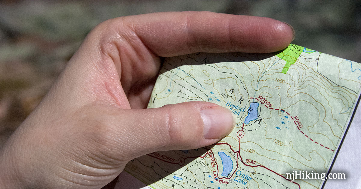
How to choose best hiking trail maps
The right map depends less on appearance than on how you plan to use it: route selection, terrain reading, coordinate navigation, or quick reference from a day pack.
Coverage area
Start with the exact area your hike will cover. A dedicated park map can provide more useful detail inside that boundary, while a regional map is better for trips involving several trail systems or multiple parks.
A single-destination map is usually easier to read when you already know where you are going. For a trip connecting Yellowstone and Grand Teton, the two-map bundle is more practical than carrying unrelated sheets and trying to reconcile their coverage.
Topographic detail
Contour lines and elevation information show how terrain changes between trail junctions. They matter when a short distance includes a steep climb, a pass, or a descent that will take longer than the mileage suggests.
The Yellowstone map explicitly includes contour lines and elevations for summits, passes, and lakes. By contrast, some products in this roundup describe topographic coverage without publishing a scale or contour interval. If terrain interpretation is central to your route, check the map legend before leaving.
A trail line tells you where to walk. Contours tell you what the walk will cost.
Scale and trail mileage
Scale determines how much ground appears on the sheet and how much local detail can fit around a trail. A map such as the Lost Creek product states a 1:48, 000 scale, while the Maroon Bells map states 1:50, 000. Both also include mileage for trail segments, which makes route planning more concrete.
Maps with a broader scope can be easier to carry but may show less detail around individual junctions. A map that gives mileage between intersections is particularly helpful when planning water, daylight, and turnaround points.
Coordinate support
A UTM grid, latitude and longitude, waypoints, or printed GPS coordinates can make a paper map work alongside an electronic device. The National Geographic Mammoth Lakes map specifically lists a full UTM grid. The Yellowstone Grand Teton bundle includes UTM and latitude/longitude grids, selected waypoints, and a scale bar.
Other maps list GPS coordinates for trailheads and junctions rather than a full grid. That can still be useful, but it is a different system. If you are also carrying a compass for sorting out position when the phone signal disappears, make sure you know which coordinate format your navigation method uses.
Material and portability
Waterproof and tear-resistant construction matters because folded paper maps spend much of their lives in damp pockets, wet vehicles, and overstuffed packs. The Yellowstone, Mammoth Lakes, Yellowstone Grand Teton, Lost Creek, Catskill, and Maroon Bells products explicitly describe durable construction.
Portability is a separate decision. The Lost Creek and Maroon Bells maps fold to about 4 by 7 inches, while the National Geographic maps have somewhat different folded dimensions. If you are also comparing pack sizes that leave room for navigation gear, a compact map can be easier to store and reach without unpacking.
Route-selection guidance
Some maps help you select a hike, while others assume you already have a route. Hike 734 Glacier Day Hikes is the clear planning specialist, with 88 day hikes, descriptions, steepness colors, and family-friendly and early-season labels.
A topographic map is better for understanding terrain and junctions. A day-hike guide is better for matching a route to a group. For a longer trip, carrying both kinds of information can be more useful than expecting one folded map to do everything.
Frequently asked questions
Are paper hiking maps still useful without cell service?
Yes. A paper map does not depend on a cell signal or an active battery, so it remains available when electronic navigation becomes inconvenient. Coordinate grids and printed GPS references can also make it useful alongside a phone or handheld GPS.
What makes a hiking map waterproof?
A waterproof map uses a material or coating intended to resist water during use. Several products here explicitly state that they are waterproof and tear-resistant, but you should still check the product description and care for the folds because repeated creasing can affect any map.
Is a folded map better than a digital map?
A folded map gives you a fixed view of the surrounding area and does not require charging. A digital map can provide live position information and easier zooming, so carrying both gives you a backup and lets each format handle what it does best.
Do all topographic maps include GPS coordinates?
No. Some list a full UTM grid, some include latitude and longitude, and others print GPS coordinates for selected trailheads and junctions. The listed features for each map should be checked rather than assuming that every topographic map supports the same coordinate system.
How detailed should a map be for a day hike?
That depends on the terrain and the number of junctions. A simple, familiar route may only need a clear overview, while a complicated trail network benefits from elevation information, junction mileage, difficulty details, and a coordinate reference.
Should I bring a map for a marked national park trail?
You should still consider bringing one. Markers can be missed, trails can split, and electronic devices can lose power. A map is particularly useful when the route includes side trails, long distances between trailheads, or changing weather.
How often should I check trail information before hiking?
Check as close to the trip as practical for closures, access changes, weather, and conditions. A map shows geography and planned routes, but it cannot guarantee that every trail is open or unchanged on the day you visit.

The bottom line
The Best hiking trail maps choice for most national park hikers is National Geographic Yellowstone Map. It combines broad trail coverage with mileage, elevation, duration, difficulty, contour lines, points of interest, and a UTM grid. For a trip that includes both parks, National Geographic Yellowstone Grand Teton Bundle is the better choice because it adds continuous coverage and strong road and navigation detail.
For more specialized needs, Hike 734 Glacier Day Hikes is the most useful planning aid, while Outdoor Trail Maps Lost Creek is the compact wilderness map we'd choose for its stated scale, trail segment mileage, GPS coordinates, and 2022 update.
If you are undecided, choose the map that matches the exact hiking area first, then prioritize a coordinate system and physical format you will actually carry.
As an Amazon Associate we earn from qualifying purchases.